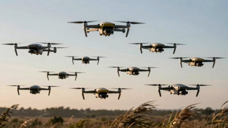
You’re seeing drones overhead because they’ve become essential tools across multiple sectors. They conduct infrastructure inspections with 91% fewer accidents, monitor agricultural fields with multispectral sensors that reduce chemical use by 60%, locate disaster victims 45% faster than traditional methods, and complete autonomous deliveries—over 1.4 million operations logged. They’re also surveying construction sites with centimeter-level precision and capturing real estate imagery that boosts sales probability by 68%. Understanding their specific applications reveals why they’ve become so prevalent in your airspace.
Capturing Stunning Aerial Photography and Video
Modern drones transform aerial imaging from specialized helicopter shoots into accessible, cost-effective operations—but capturing professional-grade footage demands far more than launching and pressing record. Successful drone photography requires mastery of manual exposure settings, ND filters for proper shutter angles, and locked white balance to prevent automatic shifts between clips. You’ll need high-resolution sensors (20MP–50MP) and 4K+ video capabilities for deliverable quality. Aerial videography depends on three-axis gimbal stabilization, vibration isolation, and practiced flight techniques: straight-line reveals establish scale, orbiting creates cinematic emphasis, and tracking shots demand stable flight modes. RAW/log capture preserves dynamic range for post-processing. Execute smooth stick inputs, maintain ISO below sensor-noise thresholds, and understand mechanical versus electronic shutter trade-offs to minimize rolling-shutter distortion during fast pans. Landscape photography benefits from aperture settings of f/8 to f/11 to achieve deep depth of field across expansive scenes. Advanced models feature omnidirectional obstacle avoidance to prevent collisions during complex maneuvers and low-altitude flights. Beyond photography, coordinated drone fleets equipped with bright LED lights create mesmerizing aerial displays through synchronized flight paths and choreographed color changes. For travelers and beginners, sub-250g models offer portability without sacrificing image quality, while content creators often prefer all-rounder platforms that balance performance with ease of use. Professional videographers increasingly demand 6K/60fps HDR video capabilities to future-proof their productions and maintain quality through post-production color grading and cropping. Professional-level drones like those equipped with dual-camera setups deliver versatility through multiple focal lengths, enabling seamless transitions between wide establishing shots and telephoto detail captures without changing altitude.
Conducting Safe Industrial and Infrastructure Inspections
Industrial facilities present inherent hazards—confined spaces, elevated structures, energized equipment, and toxic atmospheres—that you’ll navigate when deploying inspection drones under Part 107 or equivalent regulatory frameworks. Drone safety protocols reduce accidents by 91% compared to traditional methods, eliminating scaffolding-related incidents and hazardous climbs.
You’ll complete industrial inspections in two hours versus days, utilizing AI-powered analytics that achieve 95% defect detection accuracy across 400,000 daily images. Computer-vision models identify corrosion, cracks, and thermal anomalies at 85% accuracy, enabling preventive maintenance planning.
BVLOS operations allow 320-mile pipeline patrols single-day, while LiDAR integration and drone-in-a-box solutions automate workflows. Drones capture high-resolution images from various angles, providing thorough evaluations of critical infrastructure assets and hard-to-reach areas. Enterprise models equipped with thermal imaging capabilities detect heat loss, moisture intrusion, and equipment malfunctions invisible to standard cameras. Solar panel inspections benefit from specialized drones like the DJI Mavic 3T and Parrot Anafi USA that identify anomalies and defects to reduce costs and downtime compared to manual methods. Advanced platforms like the DJI Matrice 350 RTK deliver up to 55 minutes of flight endurance with precise positioning for bridge and powerline assessments. NDAA-compliant options such as the Skydio X10 and ACSL SOTEN provide AI-driven autonomy and obstacle avoidance for federal inspections of critical infrastructure.
Heavy-lift inspection drones utilize T-MOTOR U15 series motors delivering up to 28KW power and 102kg thrust for transporting specialized equipment and sensors to challenging locations. With the inspection drone market projected at USD 31.31 billion by 2030, you’ll deploy fewer operators—two versus four-plus—while achieving regulatory compliance in mining, energy, and utilities sectors.
Monitoring Crops and Optimizing Agricultural Operations
While infrastructure inspections eliminate vertical hazards through remote assessment, agricultural drone deployments address horizontal risk exposure across thousands of acres where manual scouting creates worker safety concerns—heat stress, pesticide exposure, and equipment proximity incidents. You’ll find drones equipped with multispectral and thermal sensors detect crop health anomalies through NDVI imaging, identifying nutrient deficiencies, water stress, and pest infestations before visible symptoms emerge. Precision farming systems enable targeted treatment application, reducing fertilizer and pesticide use by 60% while increasing yields up to 5%. Real-time data eliminates manual inspections, cutting labor costs and accelerating decision cycles. Drones administer inputs five times faster than conventional equipment across 50-hectare fields, transforming site-specific crop management efficiency. Crop spray drones enhance efficiency through advanced technologies like GPS and ultrasonic sensors that enable precise irrigation and pesticide application in hard-to-access agricultural areas. Professional-grade platforms like the Sony Airpeak S1 offer 5.5 lb payload capacity to mount full-frame cameras for detailed crop monitoring and documentation. U.S. agricultural drone registrations increased from 1,000 to 5,500 between January 2024 and July 2026.
Supporting Emergency Response and Search-and-Rescue Missions
When natural disasters strike or missing persons cases develop, emergency responders face critical time constraints where drones provide rapid aerial reconnaissance that ground teams can’t match. You’ll find UAVs reduce victim location travel distance by 45% while covering 43% more surface area than traditional methods. Thermal imaging and AI-powered detection systems enable real time communication between deployment teams, with some networks reaching incidents within three minutes. Semi-autonomous platforms now handle 25% of 911 calls autonomously in select jurisdictions. For disaster preparedness planning, you must address regulatory gaps, data processing bottlenecks, and privacy compliance requirements. The technology delivers cost-effective alternatives to helicopters while accessing hazardous zones unsafe for personnel, though logistical limitations require structured protocols for multi-agency coordination during earthquakes, wildfires, and floods. Modern search-and-rescue drones equipped with omnidirectional obstacle avoidance navigate complex disaster environments while maintaining autonomous tracking of victims and emergency personnel. Advanced models like the RescueStar X1 combine thermal imaging capabilities with GPS tracking and extended flight times up to 45 minutes while carrying payloads of 5 kg for medical supply delivery. Rotary-wing drones with VTOL capabilities enhance emergency response efficiency, favored for time-sensitive tasks like disaster evaluation and search missions. Specialized platforms such as the DJI Matrice 30T enable responders to conduct thermal leak detection and visual assessments across extended operational areas with prolonged flight times critical for large-scale emergency operations. Professional mapping drones like the DJI Matrice 350 RTK provide centimeter-level accuracy for post-disaster damage assessment and terrain analysis through integrated photogrammetry and LiDAR compatibility. Emergency teams increasingly pair these platforms with DJI Goggles 3 for enhanced situational awareness through immersive 4K video feeds and ultra-wide 155-degree field of view during rescue operations.
Delivering Medical Supplies and Packages to Remote Areas
Beyond locating victims in crisis scenarios, drones now address persistent healthcare delivery gaps that ground-based logistics can’t economically solve. You’ll find healthcare logistics transformed in rural markets where 80% of U.S. residents remain medically underserved. Zipline’s Rwanda deployment delivers 75% of blood supply outside Kigali, reducing product expiry rates by 67% while completing routes in 15 minutes versus hours by dirt roads. Remote delivery operations demonstrate 79–98-minute speed advantages over traditional transport (p < 0.001). The market's projected growth from USD 294.1 million (2024) to USD 3,402.03 million reflects regulatory expansion—FAA-approved UPS Flight Forward operates inter-hospital routes, while China logged 5,270 medical flights. You’re seeing GPS-guided platforms carrying 1.8 kg payloads across 96 km ranges, bypassing terrain obstacles that constrain conventional vehicles. In Malawi, a randomized control trial involving 209 health facilities demonstrated significant impacts on reducing supply stockouts and improving testing turnaround times. Advanced models like the Matternet M2 enable short-range urban hospital transfers, while AI-powered platforms expand autonomous operations for emergency response and telemedicine integration. Commercial delivery drones like the DJI FlyCart 30 offer robust payload capacity and advanced features that enable rapid, cost-effective transportation of goods across diverse terrains and urban environments. Beginner-friendly features such as altitude hold and one-key return functions make entry-level delivery drones more accessible for pilot training programs in developing regions. While medical deliveries dominate humanitarian applications, agricultural drones employ similar GPS and sensor systems to spray fertilizers and pesticides with precision targeting that reduces chemical usage and environmental impact. The same technology enabling medical logistics also powers precision irrigation systems that use multispectral imaging and thermal scanning to detect water stress and optimize resource allocation across farmland.
Creating Precise Surveys and 3D Maps for Construction
Construction site documentation has shifted from week-long terrestrial surveys to sub-hour drone deployments that capture 100-acre parcels with centimeter-level precision. You’ll achieve horizontal errors of 2–3 cm and vertical errors of 3–6 cm using RTK/PPK systems with ground control points, meeting cadastral boundary requirements.
Drone technology generates orthomosaic maps, digital terrain models, point clouds, and volumetric calculations from single flights—outputs that previously required multiple mobilizations. You’ll overlay design plans against actual ground conditions for cut/fill analysis, grading verification, and stockpile measurements without personnel entering hazardous zones. Professional mapping platforms like the DJI Matrice 350 RTK deliver 55-minute flight times with precise navigation capabilities for comprehensive site coverage. For larger construction sites spanning hundreds of acres, fixed-wing VTOL platforms offer extended endurance and wider area coverage while maintaining survey-grade accuracy. Pairing enterprise multirotors with LiDAR payloads like the Zenmuse L2 enables high-precision elevation mapping for corridor surveys and infrastructure inspection tasks. Budget-conscious teams can achieve professional surveying results with the DJI Phantom 4 RTK, which provides an entry-level platform for precise 3D mapping without sacrificing accuracy standards.
The construction efficiency gains are measurable: data collection occurs 80% faster than conventional methods, reducing documentation time by half. Weekly flights enable real-time progress tracking and BIM integration, minimizing rework. Market adoption grew 239% in construction sectors by 2018, reflecting regulatory acceptance. Accurate aerial data prevents six-figure change orders by identifying discrepancies before they escalate into costly disputes. Advanced platforms like the DJI Mavic 3 Multispectral extend surveying capabilities beyond construction to agricultural applications, capturing up to 500 acres per flight for crop analytics and field mapping.
Documenting Adventures and Outdoor Activities
While construction applications emphasize compliance metrics, recreational drone deployment introduces distinct regulatory challenges you’ll navigate across jurisdictional boundaries. Camera-equipped systems enable video storytelling through automated target tracking, producing perspectives unattainable with user-attached equipment. You’ll document outdoor exploration activities hands-free while portable systems ($300-thousands) capture aerial footage of natural features.
Beyond recreational filming, you’re managing safety protocols: thermal cameras detect wildlife in low-light conditions, elevated views assess backcountry risks, and light-emission aids pathfinding. Weather assessment becomes critical when drones photograph cloud coverage above terrain, enabling reliable forecasts during rapid meteorological changes. Trail monitoring applications demand centimeter-level accuracy for erosion assessment, while vegetation mapping supports land management decisions. High-resolution imagery enables efficient monitoring of recreation impacts that traditionally required time-intensive field inspections. Advanced RGB sensors integrated with photogrammetry software transform raw aerial data into actionable insights for environmental analysis. You’ll balance 87% public support for geographical mapping against anti-poaching compliance monitoring and species reintroduction oversight requirements.
Assessing Disaster Zones and Critical Incidents
When catastrophic events overwhelm ground-based assessment capabilities, you’ll deploy drone systems to establish operational visibility within hours rather than days. High-resolution photogrammetry reconstructs collapse geometries for structural triage, while automated algorithms classify building damage at approximately 85% accuracy. Thermal sensors detect heat signatures invisible to RGB imaging, identifying trapped victims and hidden fires during aerial reconnaissance.
For disaster response operations, you’ll prioritize critical infrastructure surveys—bridges, hospitals, substations—to inform restoration sequencing. Real-time video feeds create common operational pictures across multi-agency commands, supporting evidence-based resource allocation. VTOL platforms access hazardous zones unsafe for ground teams, while BVLOS-approved cargo drones deliver medical supplies to isolated communities. Persistent surveillance monitors evolving threats: fire propagation, flood extent, landslide progression. Tethered drone solutions enable continuous day-night coverage over extensive areas, maintaining persistent monitoring during extended emergency operations. This layered intelligence architecture compresses decision cycles when minutes determine survival outcomes. Park superintendents can grant special use permits for drone operations during search and rescue missions within national park boundaries, providing critical emergency response capabilities.
Aerial imagery captured by drones reveals inaccessible regions where traditional assessment teams cannot reach, enabling comprehensive damage documentation across entire disaster zones. Inclusive survey planning identifies vulnerable households—elderly, disabled, and poor families—requiring priority assistance and temporary shelter evaluations. Training initiatives equip local authorities with practical skills to analyze drone footage for specific damage types, transforming response efficiency across affected communities. Advanced cargo models with integrated winch systems can lower essential supplies directly to survivors stranded in challenging terrain where conventional ground access remains impossible. Autonomous delivery platforms have achieved 1.4 million deliveries in real-world operations, demonstrating the reliability needed for critical medical supply distribution during emergencies. Advanced tracking drones equipped with ActiveTrack technology can autonomously follow emergency responders through complex disaster environments, maintaining visual documentation without requiring dedicated pilot attention.
Enhancing Real Estate Marketing With Aerial Tours
As aerial platforms shift from disaster reconnaissance to commercial applications, you’ll find their highest-volume deployment in residential and commercial property marketing. Drone-captured listings demonstrate 68% higher sale probability than ground-only photographs, driven by thorough site documentation that clarifies boundaries, topography, and proximity to amenities. You’ll leverage aerial marketing to reduce buyer uncertainty through visual disclosure of adjoining land use, drainage patterns, and neighborhood density—critical inputs for property valuation and investor analysis. Photogrammetry workflows now deliver centimeter-accurate measurements for appraisal and subdivision feasibility at fractions of traditional survey costs. Regulatory compliance under Part 107 requires commercial operators to maintain visual line-of-sight and respect controlled airspace, while privacy concerns mandate careful flight planning over occupied parcels. Professional real estate photographers increasingly rely on models featuring GPS return-to-home and automated flight paths to ensure consistent property documentation across multiple listings. LiDAR technology enhances topographical mapping capabilities by providing detailed elevation data essential for comprehensive site analysis. Advanced drones equipped with 3D mapping capabilities enable precise drainage planning and soil analysis that inform property development potential and land management decisions. For real estate professionals seeking optimal aerial capabilities, sub-250g drones with professional-grade sensors offer portability and regulatory advantages without compromising image quality. Industry-leading models like the DJI Mini 5 Pro deliver 4K/120fps video with superior low-light performance through their 1-inch sensors, meeting professional marketing standards while maintaining compact form factors. The DJI Phantom series remains a top choice for real estate photography due to its ready-to-fly design and electronic image stabilization that delivers smooth aerial footage without distortion. Expect buyers to demand eight to ten aerial images per listing as baseline presentation standards.