Agricultural drones are transforming farming through precision technology that’s deployed across 500 million hectares globally. You’ll see yields increase by 5% while cutting fertilizer use by 20-25%, thanks to AI-driven multispectral imaging and real-time analytics. These systems scan fields at 10 hectares per hour, detecting crop stress early and optimizing resource allocation. They’ve already conserved 222 million tons of water and eliminated 30.87 million metric tons of CO2 emissions. The market’s projected to reach $30.70 billion by the early 2030s, with extensive training programs and evolving regulations supporting this agricultural revolution’s continued expansion.
The Explosive Growth of the Agriculture Drone Market
As global agriculture confronts mounting pressures from population growth and resource constraints, the drone market has emerged as one of the sector’s fastest-expanding technology segments. You’re witnessing projections ranging from USD 2.63 billion to USD 5.86 billion in 2026, with forecasts reaching USD 10.26 billion to USD 30.70 billion by the early 2030s. Market dynamics reflect compound annual growth rates between 20.73% and 40.60%, driven by precision farming adoption and automation demands. Investment trends show increased venture capital flowing into drone applications and data analytics software. Regional analysis reveals North America commanding 35% global revenue share in 2026, while Asia Pacific demonstrates accelerating adoption. Government subsidies, streamlined FAA regulations, and labor shortage mitigation fuel this trajectory across developed markets. The market divides into three core segments, with hardware components including drones, sensors, cameras, controllers, and batteries accounting for the largest share of revenue. This technology enables farmers to achieve comprehensive field coverage while dramatically reducing chemical usage and operational costs through targeted application of fertilizers, pesticides, and herbicides. Advanced platforms like the DJI Mavic 3 Multispectral integrate multispectral sensors with built-in RTK for centimeter-level accuracy, enabling precise crop monitoring and disease detection across 500 acres per flight. Entry-level agricultural drones feature Wi-Fi streaming capabilities that allow farmers to monitor field conditions in real-time through mobile devices during flight operations. These unmanned aerial vehicles leverage advanced GPS systems to deliver precise applications of substances. Leading crop spraying models such as the DJI Agras T50 feature dual atomized nozzles and terrain radar for large-scale precision spraying operations.
Global Adoption Reaches New Heights With 400,000 Drones Deployed
The agriculture drone market‘s explosive growth trajectory finds concrete validation in deployment figures: 400,000 DJI Agriculture drones now operate globally as of end-2024, representing a 90% surge from 2020 levels. You’re witnessing drone technology treating over 500 million hectares across 100+ countries, serving 300+ crop varieties. This agricultural innovation transcends experimental phases—countries worldwide have shifted from testing protocols to formal operational frameworks. The deployment’s environmental metrics prove significant: 222 million tons of water conserved, 30.87 million tons of carbon emissions reduced, and 47,000 metric tons of chemical products eliminated. You’ll find regulatory support accelerating adoption, with Argentina reducing deployment restrictions, Spain simplifying approval processes, and Brazil standardizing pilot training—all facilitating systematic integration of autonomous systems into global agricultural operations. The industry now benefits from 400,000 trained drone operators active worldwide, ensuring professional execution of precision farming operations. Advanced systems capable of long-range capabilities up to 30 minutes enable comprehensive field coverage in single operational sessions. Commercial agricultural operations require pilots to obtain a Part 107 certificate, which involves passing an aeronautical knowledge exam and meeting age requirements of at least 16 years old.
Dramatic Yield Increases and Cost Reductions Transform Farming Economics
Precision drone monitoring delivers quantifiable economic transformation across global agricultural operations, with early disease detection systems achieving 25% crop yield increases through multispectral imaging analysis. You’ll realize yield optimization through UAV-enabled precision agriculture, enhancing harvests by 5% while reducing fertilizer consumption by 20-25%. Cost efficiency gains materialize through variable-rate applications—Romanian vineyards cut chemical usage from 241.64 to 111.94 liters, while global operations eliminated 47,000 metric tons of chemical products.
Your ROI projections show 15-20% returns within two years, with American Farm Bureau data confirming $12 per acre returns for corn. Brazilian coffee operations achieved 70% operational cost reductions versus manual spraying. Thermal imaging prevents irrigation losses, while square-inch resolution plant counts enable precise yield forecasting, fundamentally restructuring farm economics. Agricultural drones equipped with AI autonomy enable real-time crop analysis and automated field monitoring, reducing labor costs while improving decision-making accuracy. Multirotor UAVs deliver targeted spraying capabilities that maximize flexibility in crop monitoring applications. Advanced drones equipped with RTK-accurate crop health monitoring detect water stress patterns, enabling farmers to optimize irrigation schedules and reduce waste across large-scale operations. Modern mapping platforms like the DJI Matrice 350 RTK provide precise navigation capabilities with 55-minute flight times, enabling comprehensive agricultural surveillance across extensive farmland. Advanced agricultural drones now incorporate low-latency transmission systems like OcuSync 4 to deliver real-time crop monitoring feeds directly to farm management platforms for immediate decision-making. Integrated software ecosystems including DroneDeploy and Pix4D streamline mission planning and data processing workflows, converting raw imagery into actionable field intelligence within hours.
Precision Technology: AI, Multispectral Imaging, and Real-Time Analytics
Modern agricultural drones synthesize three converging technologies—artificial intelligence, multispectral imaging, and real-time analytics—into unified precision farming systems that detect crop stress at the cellular level before visible symptoms emerge.
You’ll deploy drones equipped with RGB, thermal, and multispectral sensors that scan fields at 10 hectares per hour, generating vegetation index maps for targeted interventions. AI processes this imagery alongside IoT, weather, and soil datasets to identify nutrient deficiencies and pest infestations with pinpoint accuracy.
Real-time crop monitoring delivers immediate actionable insights through mobile platforms, enabling you to adjust irrigation and fertilization decisions on-demand. Machine learning algorithms transform raw data into predictive yield models and variable-rate seeding recommendations. These precision agriculture tools utilize granular data to enable farmers to make informed decisions about crop management strategies. Entry-level operators can begin their drone programs with budget-friendly options under $500 that still deliver 4K imaging capabilities and GPS-assisted flight features. For large-scale operations requiring extended coverage, fixed-wing LiDAR drones like the HN-VF40P deliver 12-hour endurance and hybrid VTOL capabilities that map thousands of hectares in single flights. Platforms like Deere & Company’s June 2025 system achieve seamless data integration, combining satellite, drone, and sensor inputs into extensive digital twins that replicate entire farm ecosystems for optimized resource allocation.
Environmental Benefits: Millions of Tons in Water and Carbon Savings
Agricultural drone operations have delivered quantifiable environmental returns at planetary scale: 222 million tons of water conserved and 30.87 million metric tons of carbon emissions eliminated by 400,000 deployed units through 2024. You’re seeing water conservation achieved through 10-liter-per-hectare spraying versus 250 liters with traditional tractor methods. In one five-month trial across four test areas averaging 1,000 hectares each, the drone spraying system saved 1.2 million liters of water. Beyond spraying applications, multirotor enterprise platforms equipped with advanced sensors enable farmers to optimize irrigation schedules and detect crop stress patterns that would otherwise waste resources. The integration of thermal imaging technology allows for early detection of crop health issues and inefficient irrigation zones, preventing resource waste before it escalates.
From Coffee Plantations to Vineyards: Real-World Success Stories
While theoretical metrics demonstrate drone technology’s potential, operational deployments across coffee-producing regions provide empirical validation of agricultural transformation. You’ll find coffee innovations like Brazil’s ZAi-Q100 reducing steep-terrain spraying from 20 days to 4-5 days—a 300-400% efficiency gain. The DJI Agras T40 cuts solution volume from 2,000 liters to 35 liters while reducing labor costs by 70%. Uganda’s PIX4Dfields mapping identifies pest infestations and soil erosion, enabling targeted manure application and replanting. Kauai’s monitoring system tracks 4 million trees across 3,100 acres, detecting irrigation damage within minutes. Multispectral analysis generates NDVI maps for harvest estimation, predicting 8,500 kg yields on 7.5 hectares. The ZAi-Q100’s precision application achieved seasonal labor savings of 150-180 person-days per spray cycle while reducing chemical inputs in watershed areas. Advanced thermal imaging capabilities, similar to those in the DJI Mavic 3T, enable farmers to identify irrigation defects and detect early-stage crop stress invisible to standard cameras. Mounting solutions such as universal FPV mounts ensure stable camera attachment for aerial monitoring across Mavic and Air drone models during field surveillance operations. Similar to industrial pipeline monitoring with DJI Matrice 30T, agricultural operations benefit from extended flight times and thermal detection capabilities for large-scale crop surveillance. For coastal agricultural operations near waterways, waterproof drones with IP67 ratings provide reliable monitoring capabilities even in wet conditions, protecting equipment investments while maintaining operational continuity during rainfall or spray applications. Beyond agriculture, drones are transforming mapping and surveying operations across energy, construction, and environmental monitoring sectors by improving data quality while reducing operational costs. These deployments establish operational frameworks transferable to vineyard efficiency applications.
Regulatory Evolution Accelerates Drone Integration Worldwide
Operational success in coffee and vineyard applications hinges on regulatory frameworks that enable or restrict deployment at scale. You’ll navigate compliance challenges differently across jurisdictions: US FAA Part 107 requires remote pilot certification and aeronautical knowledge testing, while Part 137 mandates Agricultural Aircraft Operator Certificates for chemical dispensing. Drones exceeding 55 pounds need 44807 exemptions. EASA standardizes rules across European member states, emphasizing privacy protections and harmonized operational limits. Trump’s 2026 Executive Order accelerates integration by mandating FAA finalize BVLOS rules within 240 days. However, the 2026 NDAA threatens DJI operations through potential FCC Covered List placement, blocking new sales and firmware updates. The FAA enforces mandatory registration for drones over 250 grams alongside visual line-of-sight operation and altitude limits. Part 107 operations permit flights up to 400 feet above ground level, though agricultural drones monitoring tall structures or silos may fly higher if remaining within 400 feet of those structures. When operating in controlled airspace near airports, pilots must obtain prior FAA authorization through systems like LAANC or the FAA DroneZone portal before conducting aerial surveys or crop monitoring missions. As of 2025, Remote ID capability is mandatory for most flights, with compliance required through either built-in drone features, add-on modules, or FAA-Recognized Identification Areas. Agricultural operators must also navigate state privacy laws that may restrict surveillance activities, particularly when flying over neighboring properties or capturing images without consent. These evolving frameworks determine whether you achieve compliant, insurable operations or face penalties and operational disruptions. Smaller farms face greater compliance burdens due to lack of dedicated teams to manage registration requirements and ongoing regulatory updates.
Training the Next Generation: 300,000 Pilots and Counting
Six thousand certified instructors now anchor a global agricultural drone training network that has produced approximately 300,000 pilots through 2024–2025, transforming workforce development across the sector. Hybrid curricula interweave online theory modules with field sessions to meet the diverse scheduling and learning needs of farmers and agricultural technicians seeking drone certification. These programs emphasize commercial off-the-shelf components to help trainees understand accessible drone technologies that can be adapted for various agricultural applications. Training courses also cover battery management systems to ensure pilots understand how to safely handle and optimize power sources for extended flight operations in agricultural settings. The educational framework prepares operators to leverage drones for tasks like surveying, where the technology can cover 120 acres in one hour compared to just 5 acres by hand, demonstrating substantial cost savings through automation and efficiency gains. Advanced programs now incorporate instruction on thermal imaging capabilities, with professional agricultural drones featuring sensors that capture detailed crop health data across large field areas. As the technology evolves, some agricultural programs are incorporating lessons on specialized software that translates flight designs into synchronized drone
Expanding Applications Beyond Crop Spraying
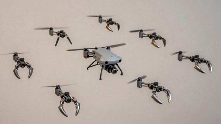
Although crop spraying remains the primary agricultural drone application, the technology now spans five distinct operational categories that reshape farm management systems. You’ll find drone versatility extends to crop monitoring, where sub-millimeter resolution captures nutrient deficiencies and pest invasions across three million acres. Soil analysis systems identify irrigation issues and drainage tile locations through variable-altitude data collection covering every half square inch. Livestock operations benefit from remote health monitoring and fly management protocols that eliminate manual inspections. Forestry applications include post-disaster assessments and invasive species removal in inaccessible terrain. These agricultural innovations enable night operations for pest control and swarming technology where single pilots coordinate multiple units, addressing soil compaction concerns while maintaining treatment uniformity across waterlogged fields and irregular topography. Advanced farms now employ drone mothership technology that serves as mobile command centers, allowing larger drones to deploy smaller sub-drones for refueling and coordinated operations across vast agricultural landscapes. Pollination drones inspired by bee behavior now address the critical challenge of declining bee populations. Modern agricultural drones increasingly feature omnidirectional obstacle avoidance systems that prevent collisions with infrastructure, livestock, and terrain variations during autonomous field operations. Precision agriculture operations now integrate LiDAR mapping capabilities to generate detailed 3D terrain models that optimize irrigation planning and identify microtopographic variations affecting crop yields. Agricultural drone pilots can expand their revenue streams by offering aerial photography services for farm real estate marketing, promotional materials, and documentation of land improvements. High-zoom cameras combined with thermal sensors enable early detection of irrigation failures and equipment malfunctions across large acreages before visible crop damage occurs.
The Future of Food Security Through Drone-Enabled Sustainable Agriculture
Beyond immediate operational gains, drone technology redefines agriculture’s capacity to meet global food demands through precision monitoring systems that deliver documented yield improvements up to 20% in field studies. You’ll leverage multispectral and hyperspectral imaging for early detection of disease, pests, and nutrient stress at plant-level resolution, enabling targeted interventions before widespread damage occurs. Near-real-time analytics compress detection-to-action cycles during outbreak events, directly increasing harvestable yields. Sustainable practices emerge through precision application of water, fertilizer, and crop protection products—drone data drives meaningful reductions in input waste while preserving beneficial organisms and preventing resistant pest populations. Site-specific irrigation scheduling informed by thermal mapping conserves water resources in drought-prone regions. Integration with IoT platforms enables closed-loop resource optimization, improving yield optimization and cumulative efficiency across growing seasons while strengthening farm-level resilience against input volatility. The economic advantages extend beyond individual operations, as farmers increasingly rent out drone services to neighboring agricultural communities, creating distributed access models that democratize advanced technology adoption.