You’ll need a Remote Pilot Certificate under Part 107 to conduct commercial cliff inspections, and you must secure FAA authorization if cliffs exceed 400 feet or fall within controlled airspace Classes B, C, D, or E. Submit altitude waiver requests through DroneZone 45–90 days prior, or use LAANC for near-real-time clearance. Maintain visual line of sight, verify Remote ID compliance, and conduct thorough hazard assessments identifying rockfall zones and wind profiles. The sections below detail equipment specifications, emergency protocols, and documentation requirements essential for regulatory compliance.
Regulatory Framework Governing Drone Cliff Inspections
Operating a drone for cliff inspections places you squarely within the Federal Aviation Administration’s regulatory sphere, demanding careful navigation of airspace rules, pilot qualifications, and operational limits before you launch. Under Part 107, you’ll need a remote pilot certificate with a small UAS rating for commercial cliff operations. You must maintain visual line-of-sight, operate only during daylight unless you’ve secured night authorization, and respect the 400-foot AGL altitude ceiling—though structure-centric inspections allow operation within 400 feet of cliff faces exceeding that height. Before each flight, verify airspace classification: Class G permits operations without prior authorization, while Class B, C, D, and surface E airspace near airports require ATC clearance through LAANC or DroneZone. Always check NOTAMs and TFRs, as these drone regulations can ground cliff operations instantly. You can pursue waivers for certain restrictions by providing evidence that your cliff inspection flights can be conducted safely. Additionally, if your inspection drone weighs over 250 grams, you must register it with the FAA and ensure compliance with Remote ID regulations, either through built-in technology or an add-on module. As drone technology becomes increasingly accessible and affordable, operators must recognize that the lowered threshold for operations brings heightened responsibility for regulatory compliance and safety protocols. Pilots should also consult local regulations specific to their region, as state and municipal authorities may impose additional restrictions on drone operations near cliffs, parks, or other sensitive locations. Flying without required prior authorization from the FAA is both illegal and dangerous, potentially leading to fines and endangering manned aircraft. You must report any operation resulting in serious injury or property damage exceeding $500 to the FAA within 10 days.
Safety Requirements and Risk Mitigations for Cliff Terrain
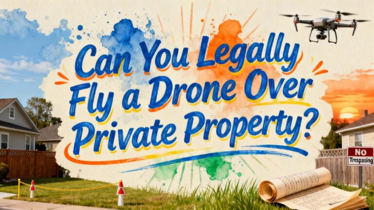
Before you position your drone near any cliff face, you must complete a thorough site hazard assessment that maps vertical relief, identifies rockfall zones, and establishes safe standoff corridors. Use Lidar or photogrammetry to document overhangs and loose-rock areas, then catalogue ground-level activity to size exclusion zones for debris displacement. Environmental considerations include monitoring wind profiles, gusts, and thermal activity—set go/no-go thresholds based on your drone’s control authority. Suspend operations during precipitation or fog that reduces sensor effectiveness. Program conservative standoff distances and automated waypoints with vertical buffers to prevent turbulent-zone incursions. Implement geofences around unstable areas and rehearse fail-safe procedures favoring lateral retreat. Hazard identification extends to communications dead zones and emergency-landing sites positioned clear of cliff-fall paths. Ensure your drone is equipped with Remote ID broadcast capability to comply with federal identification requirements during the inspection operation. If the cliff inspection occurs within a state park, verify that you have obtained any required permits for drone use and confirm that operations are allowed under both state regulations and park-specific rules. When conducting inspections near or over private property adjacent to cliff areas, ensure you comply with local ordinances that may impose additional restrictions on drone operations beyond federal requirements. Maintain visual line of sight with the drone throughout the inspection to ensure continuous monitoring of flight status and proximity to cliff surfaces. Before launching your mission, verify that you have downloaded the manufacturer’s specific application and established a secure connection between your smartphone and the drone to enable real-time video monitoring and flight controls. When operating near cliff structures, you may fly beyond the standard 400 feet altitude limit if you remain within 400 feet of the cliff’s highest point, though you should obtain proper authorization for such operations.
Required Authorizations and Waivers for Inspection Missions
When cliff faces exceed 400 feet in height or lie within controlled airspace, you’ll need to secure multiple FAA authorizations before launching your inspection mission. Submit altitude waiver requests through DroneZone 45–90 days in advance, demonstrating how you’ll maintain safety while operating above the standard 400-foot ceiling. You can fly up to 400 feet above the structure’s top if remaining within a 400-foot radius, but higher operations require formal waivers under §107.200. For cliffs in Class B, C, D, or E airspace, obtain authorization through LAANC for near-real-time approval at pre-approved altitudes, or submit requests 72 hours early for higher ceilings. Understanding these authorization processes and waiver types guarantees regulatory compliance throughout your inspection workflow. Part 107 airspace authorization requests are processed on a first come, first served basis, so timely submission is critical for mission planning. Extended flight operations benefit from drones with long battery life, such as models offering 45+ minutes of airtime to complete comprehensive cliff surveys without interruption. Select platforms equipped with omnidirectional obstacle avoidance to automatically detect and avoid cliff faces, rock outcroppings, and other hazards during close-proximity inspections. Enterprise drones like the DJI Matrice 350 RTK offer modular payloads including thermal and zoom cameras ideal for capturing detailed cliff face imagery during inspection missions. High-resolution 4K HDR cameras enable inspectors to document minute fractures, erosion patterns, and structural weaknesses across vertical rock formations with exceptional clarity. Ensure your chosen platform supports RTK/PPK positioning or GCP workflows to achieve centimeter-level accuracy when georeferencing inspection data and creating precise 3D models of cliff structures.
Equipment Standards and Payload Specifications
After securing the necessary authorizations for your cliff inspection mission, you must verify your drone meets FAA equipment standards before takeoff. Conduct a thorough preflight inspection of all safety-pertinent systems, confirming proper function before each flight. Your payload integration requires verification that inspection cameras and sensors maintain the communications link between your control station and UAS. You’ll need anti-collision lighting visible for three statute miles during twilight operations, with adequate flash rates to prevent collisions. Ascertain your drone contains no exposed rotating parts that could lacerate human skin if operating over people. Your equipment checks must confirm your UAS stays under the 55-pound maximum takeoff weight limit and supports visual line-of-sight operations without binoculars. Display your registration number on the drone’s exterior using engraving, labeling, or permanent marker as required by Part 107. All drones over 0.55 lbs must be registered with the FAA before flight operations to comply with federal regulations. As of 2025, your drone must have Remote ID capability for most flights, achieved through built-in features, add-on modules, or operations within FAA-Recognized Identification Areas.
Compliance Documentation and Risk Assessment Protocols
Every compliant Part 107 cliff inspection operation depends on three categories of documentation: certificates and authorizations, operational records, and evidence of continuing airworthiness. You’ll keep your Remote Pilot Certificate, government-issued ID, aircraft registration, and LAANC authorizations accessible during every flight. Retain detailed flight logs capturing date, time, PIC, aircraft, location, and mission purpose for audit reconstruction. Preserve maintenance records, battery histories, and firmware logs demonstrating recurring airworthiness checks.
Your compliance documentation must include formal risk assessment protocols tailored to cliff-specific hazards—rockfall, rotorwash debris, GPS degradation near terrain. Document likelihood, severity, and mitigations using risk matrices, then archive assessments with each mission record. Establish go/no-go decision criteria, environmental surveys, and residual-risk acceptance records. Implement written SOPs covering preflight checklists, VLOS requirements, and site-control measures for inspector review. When selecting equipment for cliff inspections, prioritize lightweight builds under 249g to comply with registration-friendly regulations while maintaining advanced camera capabilities. For enhanced positioning accuracy in challenging terrain, consider platforms with RTK/GNSS capabilities that deliver centimeter-level precision during photogrammetric capture. Government and enterprise operators should verify their drone selection meets Blue UAS-approved standards to ensure secure operations and compliance with federal procurement restrictions. Report any accidents causing serious injury or property damage within 10 calendar days to maintain compliance with FAA expectations. Beginner pilots conducting lower-risk training operations may consider the DJI Avata 2 for its propeller guards, 23-minute flight times, and RTF readiness that supports safer learning progression. Operators planning rescue or equipment-delivery missions should evaluate payload vs. endurance tradeoffs to ensure the aircraft can safely transport emergency supplies to cliff-side locations while maintaining sufficient battery reserve.
Emergency Procedures and Recovery Planning
Before launching any cliff inspection mission, you’ll establish thorough emergency procedures addressing equipment failures, environmental hazards, and loss-of-control scenarios. Conduct equipment checks verifying batteries, propellers, GPS, and compass calibration. Identify emergency landing zones during pre-flight surveys and outline probable failures with corresponding recovery techniques. Maintain visual line of sight throughout operations to monitor altitude, attitude, and hazards. If you encounter ash clouds or severe weather, reduce thrust to idle and reverse course immediately. Practice emergency drills including controlled descents at 1 m/s maximum during total power failure. Install prop guards to mitigate uncontrolled descent impacts. Monitor battery health indicators such as reduced flight time, swelling, overheating, and rapid voltage drops to prevent unexpected power failures during critical inspection operations. You must report all accidents, flight control malfunctions, or component failures to the FAA under Part 107 requirements, documenting date, time, location, and contributing factors. Always use batteries matched to your drone’s design specifications to ensure optimal performance and prevent component overheating during high-load emergency situations. Verify the home point establishment before each flight to enable automatic return functionality if signal loss occurs during cliff operations. Prepare plans for drone retrieval in the event the aircraft becomes inaccessible due to terrain or malfunction. Ensure your drone meets FAA registration requirements if it weighs over 0.55 lbs before conducting any cliff inspection operations. Be aware that state-specific drone regulations may impose additional restrictions on where and how you can conduct cliff inspections, particularly near private property or sensitive areas.
Airspace Coordination and Remote ID Compliance
While emergency preparedness protects you during unexpected incidents, maintaining legal airspace operations requires strict adherence to Remote ID regulations that became fully enforceable on March 16, 2024. Your drone must broadcast identification data—including serial number, location, altitude, and velocity—throughout cliff inspection flights. For airspace coordination, confirm you’re operating compliant equipment: either a Standard Remote ID drone, an approved broadcast module, or within an FAA-Recognized Identification Area. Register through FAADroneZone and verify compliance using the Declaration of Compliance system. Non-compliance risks certificate suspension and substantial fines. Remote ID enables law enforcement and air traffic controllers to monitor your operations in real-time, reducing interference with manned aircraft while facilitating safe National Airspace System integration during challenging cliff inspection missions. Recreational pilots conducting cliff inspections must maintain visual line of sight throughout all flight operations to ensure safe drone control and airspace awareness. Commercial operators performing cliff inspections must hold a Remote Pilot Certificate, which remains valid for two years before requiring recurrent training.