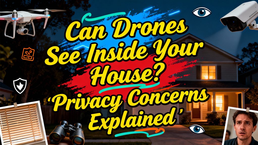
Drones can’t see through your walls, but they pose real privacy risks you shouldn’t ignore. While thermal cameras only detect surface-level heat signatures and can’t penetrate solid barriers, advanced drones equipped with high-resolution cameras, infrared sensors, and AI-powered facial recognition can monitor your activities through windows and outdoor spaces. Your Fourth Amendment rights offer some protection, particularly against low-altitude surveillance, though legal standards vary by state. Understanding what these devices can—and can’t—detect will help you assess your vulnerability and implement effective countermeasures.
Understanding Modern Drone Surveillance Technology
Modern drone surveillance systems present significant privacy implications through their integration of real-time data processing, advanced sensors, and artificial intelligence. These platforms now incorporate edge computing that processes information directly on the device, enabling instant pattern detection and anomaly identification without human oversight. Contemporary drone technology deploys thermal sensors that detect heat signatures through certain materials, while infrared cameras penetrate low-visibility conditions that traditionally protected residential privacy. Multi-sensor fusion combines these inputs to create thorough situational awareness of your property. The integration of AI-powered tracking and object recognition capabilities raises critical surveillance ethics questions, as these systems can autonomously identify patterns and behaviors without requiring operator intervention. You’re facing technology that processes encrypted data streams in real-time, making detection and accountability increasingly challenging. Advanced drones now incorporate LiDAR sensors that can map three-dimensional structures and detect objects through vegetation and other obstructions. Fixed-wing drones with VTOL hybrid designs can maintain surveillance operations for up to 12 hours continuously, significantly extending monitoring capabilities compared to traditional multirotor platforms. Compact surveillance models like the DJI Mini 4 Pro combine sub-250g stealth profiles with 4K cameras and omnidirectional obstacle sensing, making discreet aerial monitoring accessible to both commercial operators and private individuals. The extended operational capabilities of surveillance drones are supported by LiPo batteries that require careful charging protocols to maintain performance and prevent safety hazards during continuous monitoring operations. Autonomous drones equipped with flight controller software like ArduPilot can execute pre-programmed surveillance missions using waypoint navigation without requiring constant remote control operation. Courts are increasingly considering factors such as altitude, duration, and technology capabilities when evaluating whether drone surveillance constitutes a Fourth Amendment violation, reflecting the evolving legal standards around aerial observation.
What Drone Cameras Can Actually Detect
Advanced camera specifications include thermal sensors with 640×512 resolution that detect heat signatures through darkness, revealing occupancy patterns without requiring visible light. Multi-sensor platforms combine optical zoom reaching 60× magnification with infrared capabilities, enabling operators to monitor specific windows or entry points from significant distances.
These detection capabilities extend to AI-powered facial recognition and motion tracking systems that automatically identify individuals and catalog movement patterns around your property, creating persistent surveillance records without your knowledge or consent. Modern security drones equipped with LiDAR sensors can generate detailed 3D maps of structures and terrain, enabling precise navigation and obstacle detection around buildings. Professional public-safety platforms such as DJI Matrice-series systems integrate thermal and electro-optical cameras for extended surveillance operations that can monitor large areas continuously. These surveillance drones typically rely on Lithium Polymer batteries that provide high power-to-weight ratios essential for extended monitoring missions and rapid response capabilities. Some advanced waterproof models feature gimbal stabilization systems that ensure smooth, steady footage even in challenging weather conditions or during complex maneuvers around structures. Cinematic drones designed for extended flight missions often utilize Li-ion batteries that offer the longest lifespan and highest energy density for prolonged aerial operations. Drones equipped with cameras can capture images through windows just like any other camera, raising significant privacy concerns for homeowners.
The Reality of Thermal Imaging and Wall Penetration
Thermal imaging myths often claim drones penetrate solid barriers, but wall penetration limitations are absolute. These cameras detect only surface-level infrared radiation—your exterior walls block internal heat signatures completely. You won’t have indoor activities exposed through thermal surveillance.
What drones *can* detect are external temperature variations: insulation gaps, moisture intrusion, or electrical hotspots on your building’s facade. Thin materials may show heat conduction differences, but they don’t reveal interior layouts or occupants. Dense obstacles like standard residential walls absorb or reflect infrared wavelengths entirely, preventing any internal visualization regardless of sensor sophistication. Industrial inspection drones equipped with thermal and millimeter-wave radar can survey building exteriors for structural defects and energy loss patterns without compromising indoor privacy. Advanced models like the DJI Matrice 30T feature multi-sensor payloads with 640×512 thermal resolution designed for infrastructure analysis rather than invasive surveillance. Professional FPV drones used for inspection work require proper controller binding to ensure reliable operation during thermal imaging missions.
All objects emit heat as invisible infrared radiation, which thermal cameras capture and transform into visual images, but this process is limited to detecting radiation from surfaces directly exposed to the camera’s view. Portable thermal drones like the DJI Mavic 3T offer 45-minute flight times, making them practical for extended perimeter monitoring and property surveys without needing frequent battery changes. While thermal imaging itself is subject to FAA regulations, operators must also comply with state and local privacy laws that may restrict surveillance activities over private property.
Indoor Drone Capabilities and Limitations
Indoor drone operations face substantial technical barriers that severely restrict their practical deployment. GPS signal loss forces reliance on vision positioning systems that struggle in dim lighting or featureless environments. You’ll encounter indoor navigation challenges from signal interference caused by walls, metal objects, and Wi-Fi networks degrading 2.4 GHz and 5.8 GHz communications. Obstacle avoidance limitations become critical as sensors require three-meter clearances yet can’t detect small objects or moving equipment like forklifts. Constant maneuvering drastically reduces battery life while dense obstacles demand continuous pilot attention. Computer vision and LiDAR prove unreliable without adequate lighting or visual contrast. The high density of obstacles including walls, ceilings, and interior fixtures further complicates flight operations and increases crash risk. These technical constraints mean drones can’t effectively operate inside structures without expensive beaconing systems or manual control, considerably limiting their indoor surveillance capabilities.
How Autonomous Drones Navigate Private Spaces
While traditional GPS fails indoors, autonomous drones now employ sophisticated positioning technologies that enable them to navigate—and potentially surveil—private spaces without human pilots. Computer vision systems process real-time video streams to map interior environments, while QR code-based autonomous navigation follows predetermined routes through buildings. Ultrasonic positioning enables precise tracking using beacon networks, and radio frequency systems achieve seven-centimeter localization accuracy even in darkness. These autonomous navigation capabilities raise significant privacy implications, as drones can systematically document private interiors without external infrastructure or continuous operator control. Camera-based tracking systems can achieve 10-centimeter positioning accuracy indoors while operating completely offline without internet connectivity. Multi-rotor drones, including quadcopters and hexacopters, are particularly well-suited for indoor navigation due to their hovering ability and precise control in confined spaces. Modern micro drones like those with sub-250g weight can navigate indoor spaces while remaining exempt from licensing requirements in many jurisdictions, complicating privacy enforcement. Advanced systems using Pixhawk flight controllers enable sophisticated autonomous missions including computer vision-based navigation and programmable flight patterns within residential structures. The technology operates independently of lighting conditions and doesn’t require your consent to function within range of your property, creating legal gray areas regarding residential surveillance and data collection rights. All drones over 250 grams must also comply with Remote ID regulations, either through built-in technology, an add-on module, or by flying in FAA-recognized identification areas. Violating privacy protections with drones can result in serious penalties, including fines up to $5,000, equipment confiscation, and potential jail time under various federal and state regulations.
Real-Time Monitoring and Data Collection Risks
Beyond their ability to map and traverse restricted areas, autonomous drones now transmit what they observe in real time, compressing the interval between capture and distribution of sensitive visual data. Real time monitoring via HD, thermal, and night-vision feeds enables operators—commercial, governmental, or unauthorized—to observe your interior heat signatures, illuminated rooms, and window-framed activities as they occur. 5G and cloud uplinks route live streams to multiple endpoints simultaneously, multiplying exposure. AI analytics flag loitering near openings and automate alerts, creating timestamped metadata of probable privacy intrusions. While encrypted links reduce interception risk, misconfigured channels remain vulnerable. Real-time sensor fusion and automated logging mean evidence of data collection exists instantly, yet legal frameworks lag the technology’s speed and scale. Ground control stations provide operators with situational awareness and real-time video feedback, enabling precise remote monitoring from various authorized operation centers or test sites. Modern drones equipped with advanced obstacle avoidance systems can navigate closer to structures and openings, reducing safe distances that previously limited surveillance capabilities. Most surveillance drones transmit FPV video feeds using the 5.8 GHz band, a frequency range that enables reliable real-time streaming within typical operating distances. Detection systems can monitor these radio frequency transmissions to identify unauthorized drone activity near residential properties. Before operators can begin monitoring, they must power on the remote controller by pressing its power button once and immediately pressing and holding it until the device starts up, then activate the drone itself to establish the connection.
Facial Recognition and AI-Powered Tracking
As commercial and governmental operators mount facial recognition systems onto drone platforms, they’ve created a surveillance capability that identifies you from overhead without consent or notification. These systems capture high-resolution imagery, analyze facial features through algorithms measuring eye distance and jawline contours, then cross-reference your biometric signature against databases containing millions of records. Real-time processing enables immediate facial identification at ranges up to 33 feet, with AI-powered tracking following you through crowds, vehicles, and public spaces. Current deployments in stadiums and law enforcement operations demonstrate operational maturity, yet regulatory frameworks haven’t established adequate constraints on collection, retention, or cross-referencing practices. Military reconnaissance missions utilize these drone-mounted systems to identify enemy combatants and gather intelligence on target locations. The convergence of facial identification capabilities with predictive analytics raises significant AI ethics questions regarding proportionality, necessity, and your fundamental right to move anonymously through public space. Beyond surveillance applications, the commercial drone market is projected to reach $44.3 billion by 2025, reflecting the rapid expansion of drone technology across multiple sectors. Advanced drones equipped with multi-sensor integration can simultaneously collect biometric data while monitoring environmental conditions and structural details across vast areas. Consumer models with subject tracking capabilities originally designed for selfies and content creation share core AI tracking technologies that can be repurposed for surveillance when deployed at scale. Integration with existing security systems allows these drones to function as part of larger surveillance networks, creating comprehensive monitoring ecosystems that track individuals across multiple platforms and locations. Before operating any drone for legitimate purposes, users must ensure proper controller synchronization by following manufacturer protocols for battery installation, power-up sequences, and calibration procedures.
Your Legal Rights Against Drone Surveillance
Though facial recognition systems can track your movements from above, you retain constitutional and statutory protections that limit when authorities may surveil you with drones. Federal Fourth Amendment safeguards prohibit low-altitude hovering and technology beyond public availability without warrants. However, high-altitude observations using standard cameras typically face fewer restrictions under current drone regulations.
Over twenty states strengthen privacy laws by mandating warrants for drone surveillance of private property. Pennsylvania, Alaska, and Texas exemplify jurisdictions requiring judicial approval for sustained monitoring. You can report unauthorized drones to the FAA, contact local authorities, or pursue trespass claims for low-altitude flights. The ACLU recommends warrant requirements except during emergencies, emphasizing data retention limits. The Federal Aviation Administration also enforces operational rules such as visual line-of-sight requirements and altitude limits that indirectly affect surveillance capabilities. Drone pilots must obtain prior authorization from the FAA before operating in Class B, C, D, or certain Class E airspace to ensure safety in controlled airspace. Commercial drone operators must obtain a Remote Pilot Certificate by passing an aeronautical knowledge test, with certification renewed every two years. In Canada, new regulations taking effect in 2025 will introduce stricter certification requirements for drone operators, including ground school, online exams, and in-person flight reviews to enhance safety standards. While professional light show drones like UVify IFO and Lumenier ARORA are designed for entertainment purposes with features such as precision flight control and LED displays, the same navigation and camera technologies raise privacy concerns when deployed for surveillance. State constitutions often provide broader privacy protections than federal law allows. Pennsylvania’s Constitution grants independent privacy protections that extend beyond federal Fourth Amendment guarantees, offering residents stronger safeguards against intrusive surveillance.
Encryption and Cybersecurity Safeguards
While drone surveillance raises constitutional concerns, the encryption protecting collected data determines whether unauthorized parties can access your personal information. Most commercial drones employ AES-128 or AES-256 data encryption standards during transmission and storage, though implementation quality varies greatly among manufacturers. Proprietary systems like DJI OcuSync utilize encrypted telemetry with frequency hopping to prevent interception. However, protocols such as MAVLink default to unencrypted communications, creating exploitable vulnerabilities. Cybersecurity measures including end-to-end encryption, TLS/DTLS protocols, and role-based access controls theoretically safeguard your data, yet weak encryption in control links enables signal hijacking. Analog FPV systems remain particularly susceptible to unauthorized video feed access. Key Management Systems provide secure storage and management of encryption keys, preventing unauthorized decryption of collected drone footage. Military-grade unmanned aerial vehicles like the Predator drone, developed by General Atomics Aeronautical Systems, incorporate more advanced encryption protocols than consumer models. Commercial drone operators must obtain a Part 107 Remote Pilot Certificate to legally conduct business operations, which includes passing an aeronautical knowledge exam and TSA security screening. The certification process requires candidates to be at least 16 years old and pass the FAA Part 107 Knowledge Exam at an approved testing center. Consumer drones like the AR Drone 2.0 typically provide around 12 minutes of flight time per charge, which limits the duration of potential unauthorized surveillance operations. Battery management also plays a critical role in surveillance capabilities, as overheated batteries require cooling periods of 10 minutes after use before the drone can continue operations. Your practical privacy protection depends entirely on the operator’s chosen security protocols rather than inherent technological guarantees.
Practical Steps to Protect Your Home Privacy
Beyond digital safeguards, your physical property requires tangible defenses against aerial surveillance. Window coverings constitute your primary defense layer—blackout curtains block 99% of visible light while cellular shades prevent thermal imaging detection. Tinted films reduce visibility by 80% without completely obscuring natural light. Physical barriers offer secondary protection: privacy fences exceeding 8 feet obstruct drone line-of-sight, while rooftop netting deters low-altitude approaches. Consider landscaping strategies like tall evergreen trees and dense hedges to create year-round visual barriers. Modern consumer drones equipped with advanced tracking features like ActiveTrack and omnidirectional obstacle avoidance can navigate complex environments, making multiple defensive layers especially important. High-end models like the DJI Mavic 3 Pro feature triple-camera systems with telephoto capabilities that can capture detailed imagery from significant distances. Some privacy-focused individuals have explored counter-surveillance options, though understanding typical drone specifications—like the 160 ft control range found in entry-level models—helps determine realistic threat distances. Behavioral adjustments complement these measures—limit indoor lighting during evening hours and close blinds during high drone activity periods. Understanding drone capabilities matters when planning defenses—factors like sensor size and aperture directly affect how well cameras can capture detail through windows or in low-light conditions. Premium models with 1-inch sensors can capture significantly more detail in challenging lighting conditions, making robust window treatments even more critical for privacy protection. Just as 64% of internet users employ tools to protect their online privacy, implementing multiple physical barriers creates comprehensive protection against aerial surveillance. While no single solution guarantees complete privacy, layered defenses considerably reduce your vulnerability to unauthorized aerial monitoring.